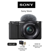
商品名称:Emlid Reach M2 Multi-band RTK GNSS Modules Centimeter Precision in RTK/PPK Less GCPs [Aonic Poladrone]
PPK mapping with centimeter accuracy.
Use fewer GCPs
Why camera synchronization is so important
Usually autopilot triggers the camera and records the coordinate it has at that moment.
When the drone is flying at 20 m/s and GPS works at 5 Hz, that means your autopilot will have position readings only each 4 m, which is not suitable for precise georeferencing.
In addition, there is always a delay between the trigger and the actual moment the photo is taken.
Reach eliminates the delay
Reach solves the problem of positioning by connecting directly to the camera hot shoe port, which is synced with the shutter.
The time and coordinates of each photo are logged with a resolution of less than a microsecond.
This method allows GCPs to be used only to check your accuracy.
1.
Connect Reach to a hot shoe port on a camera
Every time a photo is taken camera produces a pulse on a flash hot-shoe connector which is synced to a shutter opening.
2.
Fly a drone, Reach will record photo events
Reach captures flash sync pulses with sub-microsecond resolution and stores them in a raw data RINEX log in the internal memory.
3.
Download logs from Reach and base station
After the flight, get the RINEX logs from your airborne Reach module and a base station (Reach RS, CORS or another receiver).
4.
Process logs and get a file with geotags of photos
Process RINEX files using free RTKLIB software.
The produced file with precise coordinates of the photos can be used for georeferencing.
NTRIP OR ANOTHER REACH AS A BASE STATION
To calculate centimeter-precise coordinates in PPK and RTK, Reach needs corrections from a base station.
It could be either another Reach receiver or an NTRIP service.
VRS is also supported.
Compatibility
Reach M2 and M+ work seamlessly with other Reach receivers over any link and are compatible with any other receiver that supports RTCM3 and NTRIP.
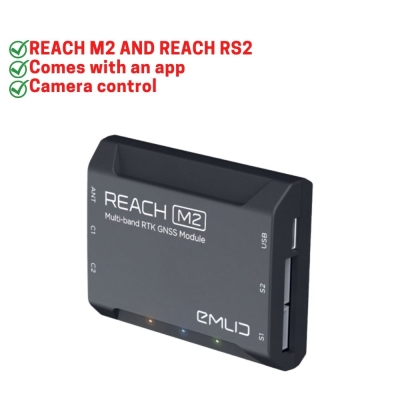
REACH M2 AND REACH RS2
Provides robust performance and quick initialization, allowing work on long baselines.
- UP TO 60KM
- UP TO 100KM
- 5 SEC
- MULTI-BAND
- UP TO 20 HZ*
coming with a software update, up to 10 Hz now
Comes with an app
ReachView is the most user-friendly software for data collection that is available both for Android and iOS.
With ReachView, you can control all the features of Reach receivers, such as setting up a base station, logging RINEX data, configuring NMEA output, and monitoring data.
Camera control
Reach is able to trigger cameras as well as register events.
The event mark feature is a must for aerial mapping as it allows the precise time when the shutter was activated to be registered.
Simple log management
Logs are automatically recorded directly to RINEX in the internal memory.
View a list of the logs and download them using the ReachView app.
Monitoring data
ReachView shows current satellite levels, your location on a map, and much more.
*International Manufacturer Warranty for 2 Months*